Santa Barbara County Redistricting Commission settles on final, preferred map
Boundary lines redrawn for County Supervisorial Districts
SANTA BARBARA COUNTY, Calif. - The independent commission established to re-draw Santa Barbara County Supervisorial Districts based on the 2020 Census has adopted a final map for the county. It follows a year-long public review process.
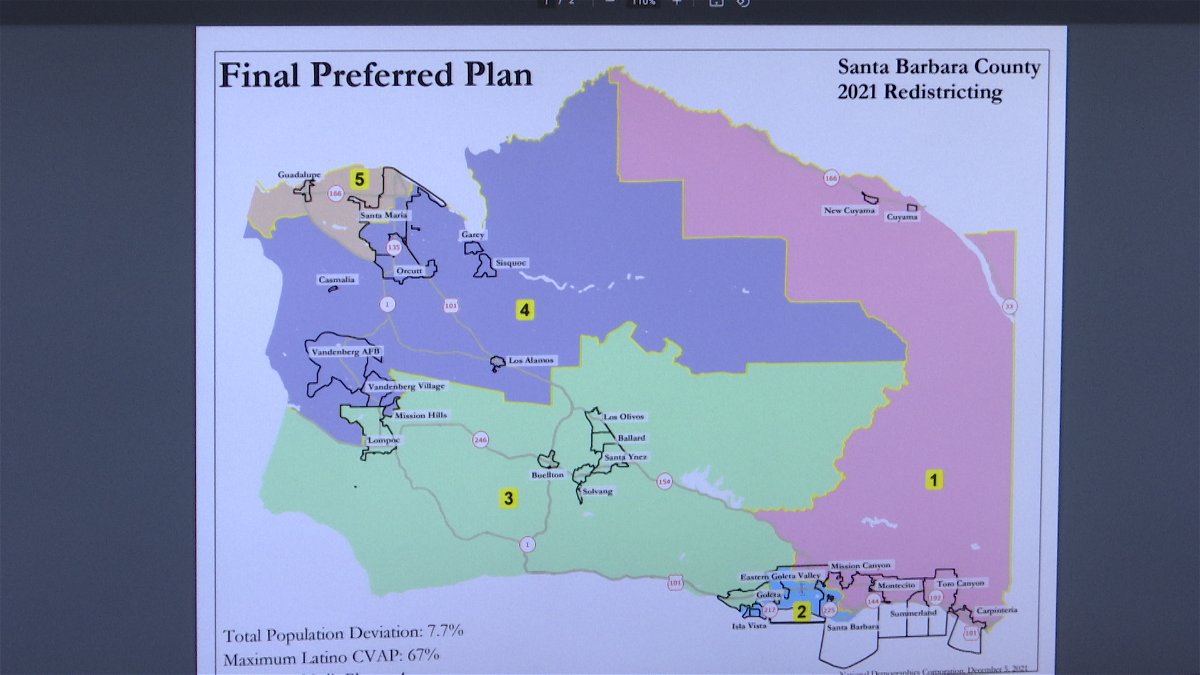
The new, preferred map by the Commission shifts Isla Vista into the Second District for the first time.
The Third District continues to straddle north and south county to include Lompoc, Santa Ynez Valley and the Goleta Valley.
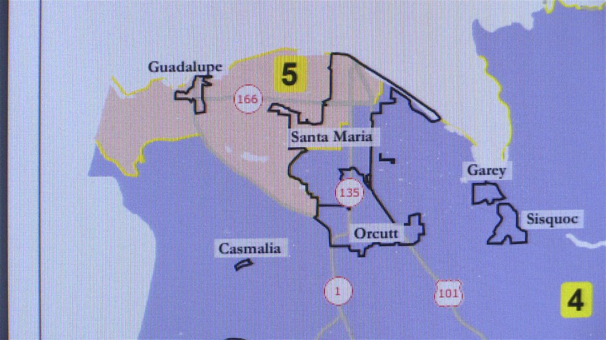
Guadalupe moves into the Fifth District which has also seen its lines redrawn notably in Santa Maria where the Fourth District extends its boundary.
The Cuyama Valley is in the First District which stretches to southern Santa Barbara County.
The Redistricting Commission is mandated to consider equal populations and communities of interest.
"We have another meeting scheduled for Wednesday night at which point we'll take final comment", said Redistricting Commission Chair Glenn Morris, "the motion before the Commission will be to affirm that map selection, I suppose it's theoretically possible we make some final tweaks if we hear something compelling on Wednesday evening or the Commission may decide we've done the best we can and here we go."
Morris says the final map was adopted among dozens that were submitted from the public.
There will be a final public meeting on the new redistricting map Wednesday night starting at 6:00 p.m. in the Santa Barbara County Planning Commission Hearing Room in the County Administration Building at 123 East Anapamu Street in downtown Santa Barbara.
Public participation can also be via Zoom, with links on the agenda website by clicking here.


