Magnitude 4.6 earthquake recorded near Malibu Friday afternoon

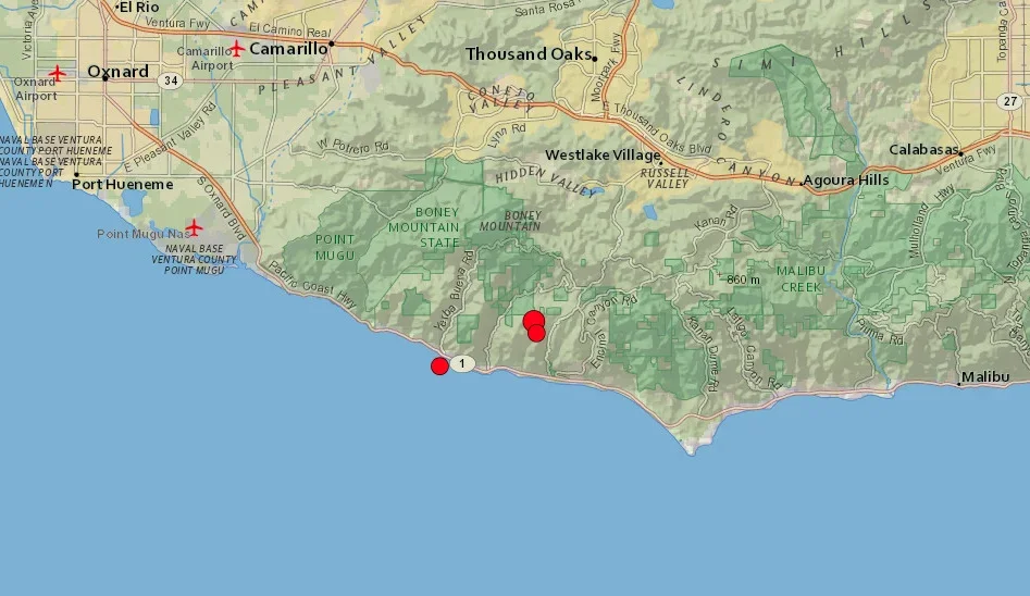
MALIBU, Calif. – The United States Geological Survey (USGS) confirmed that a magnitude 4.6 earthquake struck 12 kilometers northwest of Malibu Friday around 1:47 p.m. at a depth of five miles.
At least two other earthquakes were recorded afterward, a 3.0 magnitude earthquake 11 kilometers west-northwest of Malibu and a 3.1 magnitude earthquake 11 kilometers northwest approximately three minutes later detail the USGS website.
The location of all three earthquakes are depicted below by the red circles. The circumference of the circles demonstrates the magnitude of the recorded earthquake.

The image below from the USGS website shows fault lines, shown as red lines, in the area surrounding the earthquakes Friday.

The large deeper red line in the top right of the image above is the plate boundary, known as the San Andreas Fault.
The image below shows the San Andreas Fault, depicted by the purple line as it snakes along the California coastal region, as well as the direction of each plate, shown by white arrows.

This is an evolving emergency assessment from multiple data points and more information will be added to this article as it becomes available.
