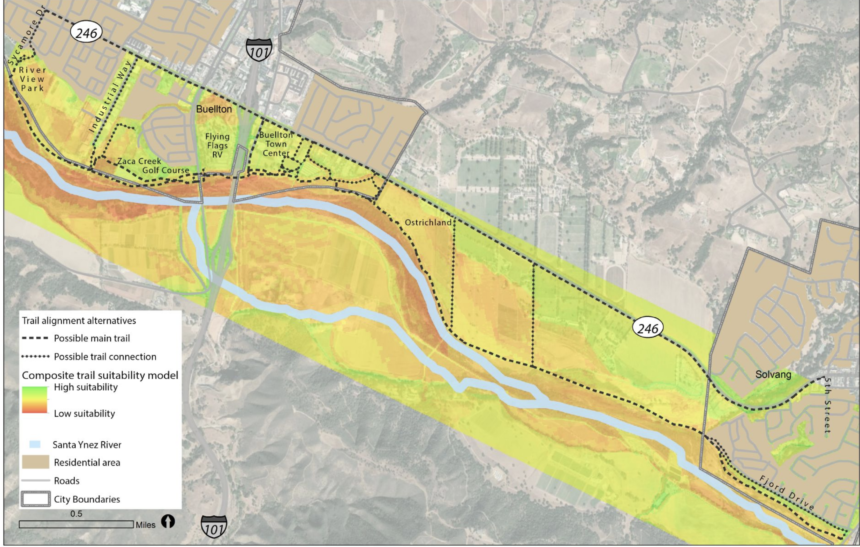
Interactive map collects public input on trail project connecting Buellton and Solvang

SANTA BARBARA, Calif. - There's now an interactive way for the public to give their input on a multimodal trail project to connect Buellton and Solvang.
Buellton and Solvang are located about three and a half miles apart but are only connected via State Highway 246. Currently, Highway 246 only has bicycle lanes within the City of Buellton and only for the westbound direction east of the U.S. 101 interchange. An ideal multimodal trail connection would accommodate bicyclists, pedestrians, and equestrians between the two cities.
This trail connection has been included in several land use planning documents and has been recognized as the highest priority project in the 2019 Santa Ynez Valley Bicycle Master Plan.
The Santa Ynez River Trail Alignment Study provides an opportunity to evaluate alignment opportunities, including along the Santa Ynez River, along Highway 246, or a variety of hybrid options.
Since an in-person public workshop to culminate a year-long public process was canceled due to the COVID-19 public health emergency, an interactive story map website was developed to graphically organize information and provide an opportunity for the public to creatively engage with all aspects of the study.
Online participants may watch brief tutorial video to guide them through navigating an online map tool available in English and Spanish. They will be able to provide direct feedback onto the map about potential multimodal trail alignments such as safety or property concerns. In addition, feedback can be given through an eight-question text-only survey.
Public comments received through the interactive website will be included in the final study document produced for this project.
To access the story map website, click here.
The Santa Ynez River Trail Alignment Study is being conducted through a partnership of Santa Barbara County Association of Governments, the cities of Buellton and Solvang, and the County of Santa Barbara.
