Santa Barbara County warns of potential flooding, debris flows in Cave Fire burn scar
SANTA BARBARA COUNTY, Calif. - Santa Barbara County officials say there is a heightened risk of flooding and debris flow during winter storms in the area near the Cave Fire burn scar.
County officials say future storms will be a concern for several years.
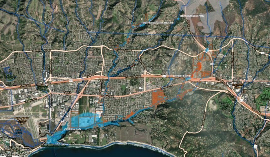
A map released by public safety agencies was released Tuesday. The map shows areas vulnerable to flooding and debris flows.
Residents can check their address on the map to see if their home or business is in an area of concern.
The County will continue to evaluate each incoming storm to determine if any protective actions need to be taken. Anyone in the affected areas should be ready to go at a moment's notice and sign up for emergency alerts at ReadySBC.org.
