Potential Cave Fire burn scar flood mapping contingent on Burn Area Emergency Response report
SANTA BARBARA COUNTY, Calif. - New Debris Flow Risk Maps unveiled Thursday night in Montecito for the Thomas Fire burn scar has some living near the Cave Fire burn scar asking about updated mapping for their area.
Ahead of a soggy weekend, post-fire response is one step at a time.
Officials say this weekend’s rain lacks the intensity needed to trigger concern because it’s spread out over an extended period of time but that doesn’t mean you shouldn’t be weather aware.
It’s hard to believe the Cave Fire started just last week and containment is still holding at 90%.
“Just because there’s a lot of area that’s inaccessible, it's steep, rugged and it’s difficult to get to, to scratch that line completely around the fire,” explains Mike Eliason, Santa Barbara County Fire Department Public Information Officer. “So on or before the 13th is when we’re expecting 100% containment,” he adds.
Now, the Burn Area Emergency Response or BAER Team, headed up by the Forest Service, is assessing the burn scar and completing important fieldwork.
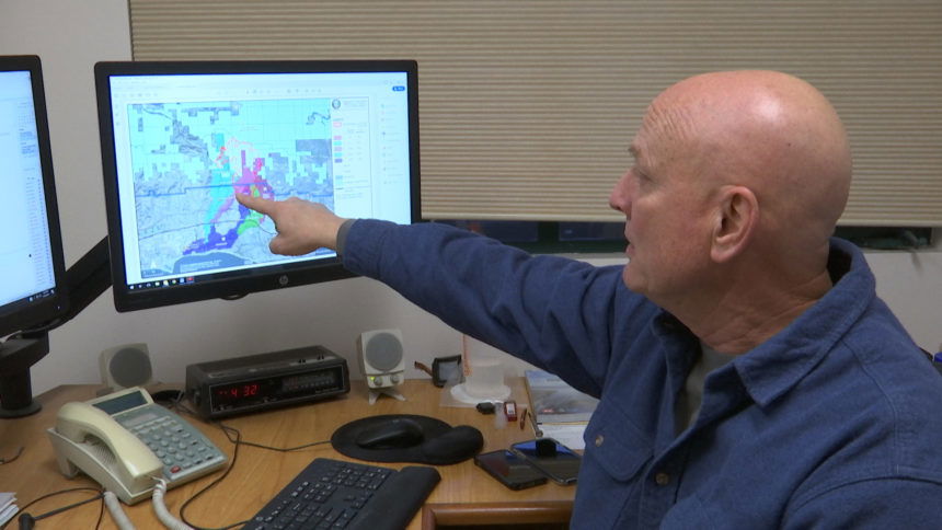
“That’s the first step, they will then produce a report and based on that report the next steps will be taken so since we haven’t received that report we don’t know exactly yet what those next steps will be,” said Jon Frye, County Flood Control Engineering Manager.
Any information on updated maps is contingent on that report but Flood Control has zeroed in on two areas.
“We know that the majority of the burn was in the San Antonio Watershed and the Maria Ygnacio Watershed about half of the San Antonio Watershed is burned and only about a quarter of the Maria Ygnacio watershed was burned,” said Frye.
In the meantime, a FEMA 100 and 500 Year Flood Map was shared with the public. It’s available online, but Flood Control wants to make it clear, it’s not a Debris Risk Hazard Map.
“This is a statistical analysis, a 100 year has a 1% chance of occurring every year and 500 is a less chance, .2% each year,” said Frye.
County stakeholders plan to meet with the BAER Team early next week to talk about next steps.
“It will tell us how concerned we need to be up there right now we’re acting as if we need to be very concerned and we’re taking every step we can in the initial stages but these things take time to develop,” said Frye.
Instead of waiting for a potential map to tell you what to do, county officials stress how important it is to have a plan and know how you would evacuate if a major roadway was shut down.
