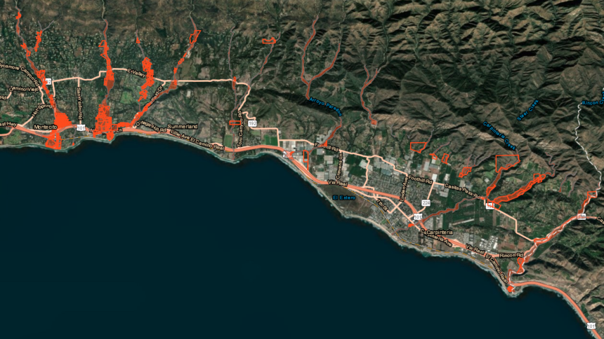
Santa Barbara County releases new debris flow risk maps

SANTA BARBARA COUNTY, Calif. - It's been nearly two years since 23 people were killed in the devastating Montecito mudslides.
On Thursday, Santa Barbara County updated its debris flow risk maps.
The maps can be found on ReadySBC.org and additional information will be released at a public town hall meeting at Montecito Union School Thursday.
The maps focus on six major creeks from Montecito to Carpinteria, all of them impacted by the Thomas Fire and deadly debris flow that followed.
Much like the recent Cave Fire maps released earlier this week, these latest maps will allow residents to see where they live in relation to creeks and if they are at risk in a debris flow.
You can find the new map here.
