Climate change is making hurricanes stronger, slower and wetter. Ida checked all the boxes
Climate change is making hurricanes stronger
By Rachel Ramirez, CNN
Human-caused climate change is making hurricanes more dangerous. They are producing more rainfall, moving slower once they make landfall and generating larger storm surges along the coast. Hurricane Ida was a prime example of those changes, and scientists say storms like this will become more common as the planet warms.
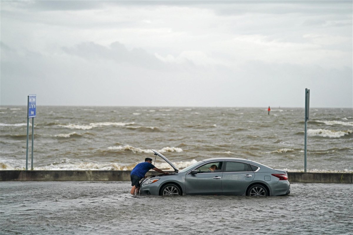
Fueled by warmer-than-normal water in the Gulf of Mexico, Hurricane Ida destroyed homes, uprooted trees and cut off power to more than 1 million residents. It battered Mississippi and the already storm-ravaged state of Louisiana, and officials there say they expect the death toll to increase in the coming days.
Hurricane Ida was just the latest in back-to-back storms that have slammed Louisiana in recent years. But Katharine Hayhoe, chief scientist at the Nature Conservancy and professor at Texas Tech University, said an important distinction is not the frequency of the storms but their severity.
“We’ve always had hurricanes, we’ve always had heat waves, we’ve always had floods and droughts, but what climate change is doing is loading the weather dice against us,” Hayhoe told CNN. “It’s sneaking in when we’re not looking, changing the numbers as we’re rolling and asking what is this, how could this happen?”
“The answer to that is climate change,” she said.
Hurricanes are getting stronger
Hurricanes — also called tropical cyclones or typhoons outside North America — are being made more intense by the warming ocean, which studies have shown has absorbed approximately 90% of the planet’s excess heat trapped by human-produced greenhouse gas emissions. And a recent study found that the planet is trapping roughly double the amount of heat than it did nearly 15 years ago.
As the planet heats up, storms get stronger.
The recent state-of-the-science United Nations report on climate change concluded that the global proportion of cyclones ranging from Category 3 to 5 — the most intense storms — has increased over the last four decades due to rapidly warming ocean temperatures. For every additional degree of warmth, scientists say not only will the proportion of intense cyclones continue to climb, but extreme rain events are also forecast to intensify by about 7%.
“We know that, in general, hurricanes are intensifying faster,” Hayhoe said. “They are bigger and stronger than they would be otherwise; they have a lot more rainfall associated with them, and rising sea level exacerbates storm surge.”
Before making landfall on Sunday, Hurricane Ida went through a remarkable period of strengthening: its maximum sustained winds increased by 65 mph in just 24 hours.
Scientists define rapid intensification — a process that historically has been rare — as an increase of 35 mph in 24 hours or less. Hurricane Ida nearly doubled that definition.
For rapid intensification to occur, warm ocean water must extend well below the surface, going hundreds of feet deep, to provide enough engine for the hurricane to strengthen. This has led scientists to believe that storms are more likely to undergo rapid intensification as a result of warmer oceans.
“If you increase the speed limit, you make more room for the storms to strengthen, so it can intensify more quickly,” Jim Kossin, a senior scientist with the Climate Service, an organization that provides climate risk analysis to governments and businesses, told CNN.
Ida made landfall in Louisiana as a Category 4, and is now tied in the record books with Laura in 2020 as the strongest hurricane to make landfall there.
Hurricanes are wetter and moving slower
Storms are also generating more rainfall. For every degree of warming, the atmosphere can hold 7% more water vapor that could fall as rain. After flooding from Hurricane Harvey devastated the Houston area in 2017, scientists found that human-caused climate change supercharged the storm’s rainfall by approximately 15%.
Hurricane Ida has dumped more than 15 inches of rain on parts of Louisiana, according to the National Weather Service. As the remnants of the storm arc from the South to New England, another 3 to 7 inches of rain is expected across at least 12 states, including areas already impacted by severe flooding this month such as Tennessee and New Jersey.
Paul Miller, a coastal meteorology scientists at Louisiana State University, said southeast Louisiana, including Baton Rouge and New Orleans, experienced one of its wettest seasons on record. According to Miller, it rained on 91% of the days between June 18 and July 19 at the New Orleans airport, compared to the region’s average of 40-50%.
“It’s been a historically wet year in southeast Louisiana even before Ida,” he told CNN. “This really exacerbated concerns about flooding during Ida because the ground had already absorbed a lot of water this year.”
Satellite data also shows that storms are getting slower, particularly after they make landfall, according to Hayhoe. Slower and larger storms means they can cover a greater area, idle and dump more rain during that time period.
And, while experts say the research is still developing, a 2020 study published in the journal Nature found storms are staying stronger farther inland than they did five decades ago. Since hurricanes are fueled by warm ocean water, they tend to weaken over land, but in recent years they have been raging longer after landfall. The study concludes that warmer sea surface temperatures are leading to a “slower decay” by increasing the amount of moisture that a hurricane can carry.
Storm surge is getting higher
Storm surge, the flooding that occurs when hurricane winds push ocean water over land, is also getting worse due to sea level rise. Hayhoe said storm surge can inundate a larger area now than it would from a hurricane of the same intensity about 50 or 100 years ago.
As the water piles up along the coast, rivers and streams that drain into the ocean can also be blocked, forcing water levels to rise upstream. Storm surge and strong winds from Hurricane Ida reversed the flow of the Mississippi River near New Orleans on Sunday — something the US Geological Survey says is “extremely uncommon.”
Scott Perrien, a hydrologist with the USGS, told CNN that the river’s level on Sunday rose about 7 feet due to storm surge at the gauge located in Belle Chasse, about 20 miles south of New Orleans. At the same time, the river’s flow “slowed from about 2 feet per second down to about half a foot per second in the other direction,” Perrien said.
“I remember, off hand, that there was some flow reversal of the Mississippi River during Hurricane Katrina,” Perrien said, “but it is extremely uncommon.”
Tom Knutson, senior scientist with the National Oceanic and Atmospheric Administration, said combined with wind and rain, storm surge is “one of the more dangerous aspects of hurricanes.”
Nearly half of all deaths from tropical cyclones come from storm surge.
Louisiana’s natural buffer against storm surge — its coastal wetlands — are also disappearing due to sea level rise and persistent severe hurricanes. “Watching each additional hurricane, like Ida, hit the state, is a reminder of the importance of preserving and restoring these environments,” Miller said.
As the ocean gets warmer due to fossil fuel emissions, the Gulf Coast will likely experience more hurricanes that are as severe as Ida. Hayhoe said the only choice humans have left is to either rapidly cut greenhouse gas emissions or face the most catastrophic impacts of the climate crisis.
“The bottom line is climate change is not only an environmental issue or a coastal issue, climate change is an everything issue — a human issue,” Hayhoe said. “To care about climate impacts and to advocate for climate action, we only have to be one thing, and that one thing is a human living on planet Earth.”
The-CNN-Wire
™ & © 2021 Cable News Network, Inc., a WarnerMedia Company. All rights reserved.
CNN’s Brandon Miller contributed to this report.