Central Coast braces for week of rain about to begin in California
SANTA BARBARA COUNTY, Calif. - After a long dry spell dating back to last Spring, significant rain will come into California in the next week including the drought-challenged Central Coast.
The National Weather Service says residents in areas including Montecito, Santa Barbara and Goleta should see some light rain falling tonight after 7 p.m. into tomorrow morning.
Rain is forecasted Sunday night.
The big event will begin sometime late Tuesday night or Wednesday morning. Periods of rain, heavy at times, will come down.
Estimated totals at this point indicate it could be about four inches by next Friday.
The area has been mostly dry since late Spring and early Summer, except for a strong downpour Dec. 27. That rain dropped a surprise hail blast on Santa Barbara surface streets including Chapala and Pueblo.
Wind gusts damaged outside patio and parklet structures in the Funk Zone.
The First Alert Weather Center is tracking the storm closely. Snow levels by the end of the week will be below 2000 feet in some areas.
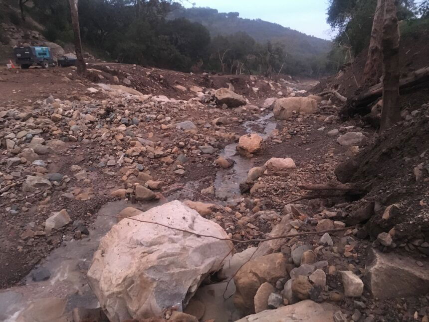
Warnings have also been posted to remind residents that recent burn areas remain prone to debris flows and a dangerous runoff.
One resident Spencer Vaughn was out of the path of the Montecito mudflow that took 23 lives in 2018. "I think we have hopefully everything in control. The mediation of the boulders, the new channels for water and whatever else they did to make it safer for us all."
Montecito residents are quick to talk about weather risks, especially when multiple inches of rain have been forecasted. They continue to look up in the hills, or down into creeks and know what nature can throw down with a wet weather pattern.
Marianne Hanley said, "if you look at how close we are to the mountains it's kind of scary, sometimes and I think about it a lot. Hopefully, there's not a lot of loose debris up there that could come down. They have done a tremendous amount of work on the drainage systems."
Her husband, George said, "you just have to have proper drainage and people took care of the storm drains and stuff earlier this week."
Someone familiar with the debris flow prevention work, John Sorosky said,
"The guys have done a great job. Pat and his crew have done a great job getting those nets in there and with a little help it will all go well."
He's referring to former Santa Barbara City Fire Chief Pat McElroy who led an effort to have ring nets installed in the Montecito canyons to hold back rocks and boulders in another big emergency storm crisis. The prevention plan has since been used in similar fire zones where mudflows are likely.
The Montecito and Carpinteria front country hills are still vulnerable, and residents need to stay alert in often unpredictable and intense rains.
"People need to get out if that's what it calls for. Mother Nature bats last, " said Sorosky.
For more information go to Office of Emergency Management.
